Satellite Fire Tracking Decodes Human Influence on Wildfire Risk
Satellite fire tracking data from 2020 lockdowns isolates human influence on global wildfires, revealing complex regional trade-offs for risk management.
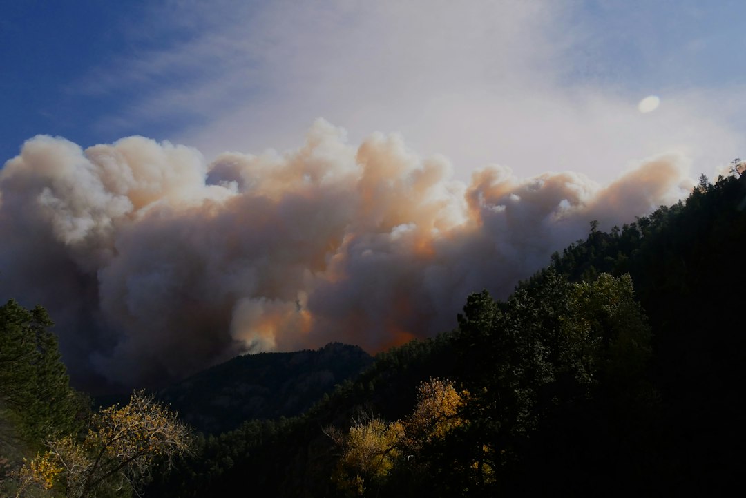
Researchers leveraging orbital remote sensing instruments have utilized the global societal disruptions of early 2020 to quantify the direct influence of human mobility on worldwide fire patterns. Published in Cell Reports Sustainability, a study led by Jianghao Wang of the Chinese Academy of Sciences analyzed spaceborne thermal imaging alongside mobile device telemetry to establish a rare natural experiment baseline. The findings reveal that, after strictly adjusting for atmospheric variables, human lockdowns produced a net 12.3 percent reduction in active fire detections across restricted zones, demonstrating how human activity and suppression efforts simultaneously shape global fire behavior.
Understanding the exact proportion of wildfire activity driven by human behavior versus natural climate conditions has long posed a fundamental challenge for environmental scientists. Because human movement, agricultural cycles, and seasonal weather patterns normally fluctuate in tandem, isolating human influence requires extraordinary circumstances. The temporary cessation of routine travel and industrial operations during 2020 created an unprecedented observational window to measure what happens when human presence across natural landscapes is suddenly dialed back.
Disentangling Weather Variables from Human Activity
To separate atmospheric drivers from anthropogenic ones, the research team harmonized global weather parameters—including relative humidity, surface temperature, precipitation, and wind speeds—with location data extracted from cellular networks and administrative lockdown schedules. Without adjusting for meteorological factors, the raw satellite data indicated a minor 5.8 percent drop in thermal anomalies, a figure that lacked statistical significance.
However, once atmospheric normalization was applied, the true net impact emerged. Weather conditions in early 2020 were exceptionally favorable for fire generation in several regions, effectively masking the reduction brought on by restricted human movement. Accounting for these background climate conditions revealed that human-influenced fire activity dropped far more sharply than initial surface observations suggested.
The magnitude of this shift varied dramatically depending on the surrounding ecosystem:
- Forest Environments: Experienced the most pronounced drop, with active fire detections plunging by 27.7 percent under restricted mobility.
- Grassland Ecosystems: Recorded a moderate decline of 8.4 percent in fire occurrences.
- Shrublands and Savannas: Showed minimal statistically significant change, suggesting that fire dynamics in these biomes are governed predominantly by fuel moisture and natural ignitions rather than human contact.
VIIRS Telemetry and Spatial Resolution Capabilities
The quantitative backbone of the study relies on orbital Earth observation instruments, specifically the Visible Infrared Imaging Radiometer Suite (VIIRS) aboard the NASA/NOAA Suomi NPP satellite platform. Operating at a spatial resolution of 375 meters per pixel, VIIRS detects thermal radiation emitted by surface hot spots, granting researchers the ability to track active ignition fronts across remote terrain.
Despite its high thermal sensitivity, satellite fire tracking presents inherent remote sensing limitations. Orbital radiometric sensors detect localized surface heat signatures but cannot infer human intent or distinguish between an uncontrolled wildfire, an agricultural burn, or a planned forestry intervention. Consequently, continuous thermal anomalies registered over a single geographic grid cell may represent either a prolonged, expanding wildfire or a series of localized ignition events.
Furthermore, cellular location datasets naturally exhibit lower sampling density in sparsely populated rural zones compared to urban centers. Because remote wilderness areas are often where lightning-driven ignitions and severe forest fires occur, combining mobile location telemetry with orbital observations requires sophisticated statistical smoothing to avoid urban sampling bias.
The Suppression Paradox: Why Some Regions Saw Fire Surges
While the global aggregate reflected a net reduction in fire detections, regional breakdowns uncovered a complex dynamic: restricting human mobility did not universally suppress fire activity. In multiple regions across South America, Southern Africa, and Northeast Asia, active fire detections surged dramatically during local movement restrictions.
Notable regional spikes included:
- Honduras: Recorded a dramatic 70.7 percent increase in active thermal detections.
- Colombia: Observed a 31.4 percent rise in fire activity during the restriction window.
- India: Saw fire detections climb by 25.4 percent above historical baselines.
This divergence underscores the dual role humanity plays in wildfire regimes. While humans act as a primary ignition source through equipment use, debris burning, and recreation, human infrastructure also provides critical fire suppression capabilities. When public health restrictions curtailed ranger patrols, localized suppression teams, and monitoring personnel, ignitions that occurred in remote areas were left to burn unchecked for longer durations. Consequently, reduced suppression capacity in vulnerable regions outweighed the benefit of fewer accidental ignitions, leading to larger overall burn footprints.
Prescribed Burns and Orbital Remote Sensing Gaps
The research also highlighted how human disruption impacts controlled land management practices. In an analysis of 12 nations maintaining official records of controlled burns, the total surface area subjected to prescribed burning dropped by approximately 50 percent compared to the 2013–2019 historical baseline. Forestry agencies routinely execute prescribed burns during cool, moist periods to consume excess brush and reduce catastrophic wildfire risks during dry seasons.
Because satellite sensors classify prescribed burns and uncontrolled wildfires under the same thermal detection metrics, reduced land management activity directly altered overall satellite counts. When researchers excluded known prescribed burn zones within those 12 countries, the observed decline in fire detections shifted from 45.3 percent down to 27.8 percent. This demonstrates how human fire management decisions significantly skew satellite-based environmental monitoring if management metadata is not integrated into analytical models.
Next-Generation Inputs for Earth System and Wildfire Modeling
The insights gained from this natural experiment provide a blueprint for updating predictive fire management software and climate risk algorithms. Traditional predictive models rely heavily on climate telemetry, fuel load indices, and historical weather patterns, often treating human ignition and suppression as static constants. Incorporating dynamic human mobility telemetry—such as real-time travel indices, agricultural activity feeds, and ranger patrol density—can substantially sharpen the accuracy of predictive wildfire analytics.
Moving forward, disaster response agencies and environmental data scientists must move away from uniform, one-size-fits-all fire prevention policies. In densely populated forest interface zones where human ignitions dominate, public education and access restrictions during peak drought remain paramount. Conversely, in expansive wilderness areas where fire suppression teams prevent small ignitions from growing into megafires, maintaining operational patrol capacity during societal disruptions is essential to preventing catastrophic forest loss.
Reporting reference: this briefing is TechWire’s independent analysis. Primary reporting was published by Ars Technica — read the source article.
Related analysis
x86 Processor Evolution: How Legacy Trade-Offs Won
Explore the x86 processor evolution, from 1970s hardware choices to modern computing compatibility, explaining little-endianness and register design.

NSF Leadership Nomination Collapses Amid Science Policy Crisis
Senate pushback on the NSF leadership nomination highlights growing friction over federal science funding and academic research oversight.

TRMNL Frame: Full Color ePaper Display Canvas Debuts
An analysis of TRMNL Frame, a 31.5-inch full color ePaper display using Spectra 6 tech, custom color engines, and in-house manufacturing.